Fiery forest revisited
Exactly one year ago this month, the White Mountains of eastern Arizona were ablaze with the Wallow Fire, the largest fire in state history. The human-caused fire scorched more than 530,000 acres in four counties in Arizona and one in New Mexico, significantly damaging or destroying hundreds of thousands of acres of wilderness habitat, as well as historic and residential buildings, water and timber resources, and range-land.
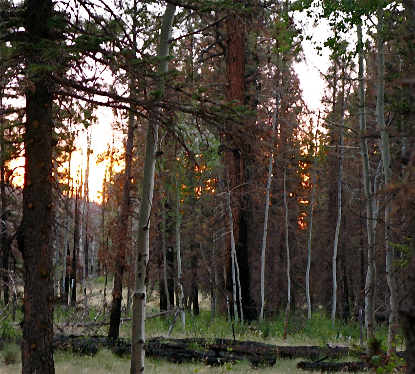
This weekend, E and I hiked and camped in the high-altitude mixed conifer-aspen, near-alpine grassland biome near Mt. Baldy, curious to see how the fire had affected some of the areas we know and love. In the few days we were there we found big changes, but perhaps not as drastic as we feared. We were able to camp and hike in favorite places, each scarred but not destroyed by the wildfire’s effects. The campground was only marginally burnt. I would love to know if this close call was a natural quirk of fire topography, or if firefighters saved the campground.
<< aspen and ponderosa forest damaged by the 2011 Wallow Fire (Photoshopped edit, A.Shock photo)
Our relief that things weren’t worse than they were is the result of a non-technical, tourist viewpoint. For residents, both human and wildlife, the fire changed the landscape in ways that will not be restored in our lifetime. Blackened trees stand everywhere, some killed outright, others damaged and struggling. Fallen trees — some reduced to a trunk-sized trail of ash — criss-cross the forest floor. Some of the downed trees were felled as part of federal and state agencies’ safety strategies intended to make the most seriously burnt areas safer for hunters, hikers, and fishermen: many hazard trees near roads, structures, in campgrounds, and along trails have been cut down and piled into charred heaps by feller-buncher equipment and saw-crews. Bright yellow signs posted at every trailhead and forest road junction caution people venturing into the back country that flames are not the only dangers of fire: once the fires are out, flash flooding, falling trees and branches, and landslides are the legacy of wildfire for seasons to come.
But not all of the forest suffered equally: crown-fire areas, where the flames jumped from treetop to treetop, burnt hotter than others and show more severe damage. Ground-fire areas burnt  spottily, while other places were only lightly toasted. Some pockets were not touched by flames at all. Yet each of these places shows a welcome resurgence of life.
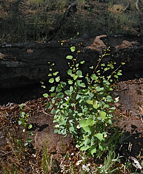
>> a foot-tall aspen regrowing in the shelter of a charred ponderosa trunk (Photoshopped edit, A.Shock photo)
Although Ponderosa pines appear to be hard hit in many places, aspen trees and firs growing alongside them often seem to have sustained less damage. In addition, 2012’s snowmelt and spring rains provided most areas with a green carpet of grass, re-sprouted shrubs, and young trees. Elk cows trail gangly calves, and busy Barn swallows, Hermit thrushes and Brewer’s blackbirds have bug-filled beaks, carrying food back to their nestling broods. A pair of Bald eagles has built a nest in the woods crowning a peninsula of a popular fishing lake: a joyful reason for an area closure, unlike the parts of the forest still closed to recreation because of severe fire damage.
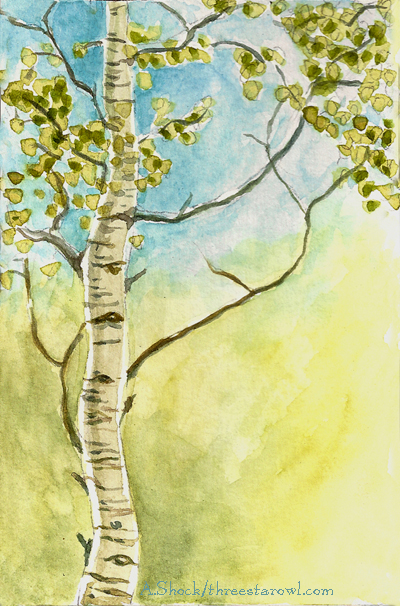
<< watercolor sketch of small aspen that survived the fire (A.Shock)
The flame-colored sky in the background of the top image is reminiscent of the fires that swept through the area last year. But it’s just a mid-June sunset glowing behind the aspens and Ponderosa pines where we camped. Ironically, the blazing sunset is caused by smoke particles in the air, wafting from wildfires currently burning in Arizona and New Mexico — the Poco fire near Young, AZ, and the enormous, lightning-caused Whitewater-Baldy Fire in New Mexico’s Gila National Forest , now classed as the largest fire in the history of that state.
